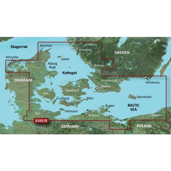
Garmin Bluechart g3 (EU021R) Denmark east - Sweden southeast
Garmin Bluechart g3 (EU021R) Denmark east - Sweden southeast
Description
The Garmin BlueChart g3 marine charts offer industry-leading coverage, clarity, and detail with integrated data from Garmin and Navionics. Additionally, it includes Auto Guidance1 which uses desired depth and clearance to calculate routes and display a suggested path overlaid on the chart. NOAA raster cartography is also available as a free downloadable feature via the ActiveCaptain app. It provides paper-like chart views of NOAA-surveyed areas where individual points of interest are marked with longitude and latitude information. We cover the entire world with accessory cards or downloadable charts sorted by region. Each region is sold separately.
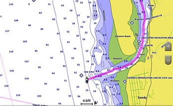
Auto Guidance
The Auto Guidance1 feature quickly calculates a suggested route using desired depth and clearance.
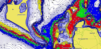
Depth Range Shading
This feature displays high-resolution depth range shading for up to 10 depth ranges so you can see the depth of an object.
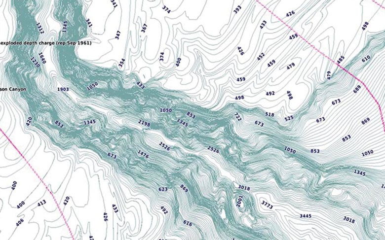
Detailed Contours
The BlueChart g3 charts have 1-foot contours that provide a more accurate representation of bottom structure for improved fishing charts and greater detail in marsh, channel, and harbor maps.
Shallow Water Shading
Shallow water shading aids
Garmin Bluechart g3 (EU021R) Denmark east - Sweden southeast
In stock Few left in stock
The Garmin BlueChart g3 marine charts offer industry-leading coverage, clarity, and detail with integrated data from Garmin and Navionics. Additionally, it includes Auto Guidance1 which uses desired depth and clearance to calculate routes and display a suggested path overlaid on the chart. NOAA raster cartography is also available as a free downloadable feature via the ActiveCaptain app. It provides paper-like chart views of NOAA-surveyed areas where individual points of interest are marked with longitude and latitude information. We cover the entire world with accessory cards or downloadable charts sorted by region. Each region is sold separately.
Auto Guidance
The Auto Guidance1 feature quickly calculates a suggested route using desired depth and clearance.
Depth Range Shading
This feature displays high-resolution depth range shading for up to 10 depth ranges so you can see the depth of an object.
Detailed Contours
The BlueChart g3 charts have 1-foot contours that provide a more accurate representation of bottom structure for improved fishing charts and greater detail in marsh, channel, and harbor maps.
Refers to which product family the product belongs to. In many cases, there are matching reels and rods within the same product family. These items are designed to work together.